Verkfæri ehf
544-4210
Vsk nr. 103399
Kt. 561209-0220
sale@verkfaeriehf.is
Bugðufljót 11, 270 mosfellsbær
lækjavöllum 2b, Akureyri
Leica gps30
Leica iCON gps 30 – Smart Antenna for Construction The ultimate entry-level antenna for digital construction workflows. Designed to facilitate the shift from traditional measurement methods using tapes and strings to modern digital methods, the iCON gps 30 offers an easy-to-use
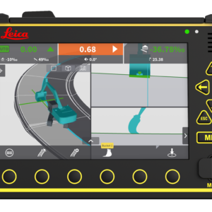
The iCON gps 30 is an exceptionally lightweight and compact GNSS RTK rover, built with the operator in mind, providing consistently accurate positions through advanced RTK technologies. Integrated with the well-established iCON field software and tailored to typical construction workflows, the iCON gps 30 speaks the language of construction site professionals.
Leica iCON gps 30 – providing accurate positions
Entry-level Smart Antenna
First and easy step into digital workflows that provide more productivity, efficiency, and quality of work!
Ideal stakeout GNNS
The light, compact and balanced design of the iCON gps 30, makes it comfortable to use and carry in the field. With the highest level of position reliability in its class, the iCON gps 30 is the best stakeout support you can have.
Leica iCON gps 30 features:
Increase productivity of any construction project by adapting digital measurement methods
Define and document the position of water and sewer lines, oil and gas pipes, or power and communication lines as part of the utility construction process
Stakeout rough outlines for subsequent building construction tasks or subdividing real property
Transfer outlines from design to field in landscape gardening projects or road construction
Simple survey of ground control points for UAV workflows
Leica iCON gps 30 – Smart Antenna for Construction
The ultimate entry-level antenna for digital construction workflows.
Designed to facilitate the shift from traditional measurement methods using tapes and strings to modern digital methods, the iCON gps 30 offers an easy-to-use and economical solution for construction measurement tasks.
The iCON gps 30 is an exceptionally lightweight and compact GNSS RTK rover, built with the operator in mind, providing consistently accurate positions through advanced RTK technologies. Integrated with the well-established iCON field software and tailored to typical construction workflows, the iCON gps 30 speaks the language of construction site professionals.
Leica iCON gps 30 – providing accurate positions
Entry-level Smart Antenna
First and easy step into digital workflows that provide more productivity, efficiency, and quality of work!
Ideal stakeout GNNS
The light, compact and balanced design of the iCON gps 30, makes it comfortable to use and carry in the field. With the highest level of position reliability in its class, the iCON gps 30 is the best stakeout support you can have.
Leica iCON gps 30 features:
Increase productivity of any construction project by adapting digital measurement methods
Define and document the position of water and sewer lines, oil and gas pipes, or power and communication lines as part of the utility construction process
Stakeout rough outlines for subsequent building construction tasks or subdividing real property
Transfer outlines from design to field in landscape gardening projects or road construction
Simple survey of ground control points for UAV workflows
 Verð án VSK
skoða nánar
Verð án VSK
skoða nánar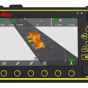 Verð án VSK
skoða nánar
Verð án VSK
skoða nánar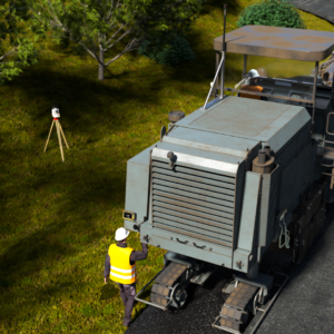 Verð án VSK
skoða nánar
Verð án VSK
skoða nánar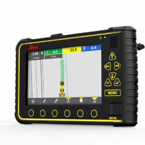 Verð án VSK
skoða nánar
Verð án VSK
skoða nánar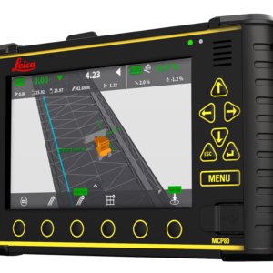 Verð án VSK
skoða nánar
Verð án VSK
skoða nánar Verð án VSK
skoða nánar
Verð án VSK
skoða nánar Verð án VSK
skoða nánar
Verð án VSK
skoða nánar
Verð án VSK
skoða nánar
Verð án VSK
skoða nánar Verð án VSK
skoða nánar
Verð án VSK
skoða nánar
Verð án VSK
skoða nánar
Verð án VSK
skoða nánar